
Fayl:Russia Chukotka Autonomous Okrug location map.svg

Size of this PNG preview of this SVG file: 702 × 599 pixels. Başqa çözüm: 281 × 240 pixels | 562 × 480 pixels | 900 × 768 pixels | 1.200 × 1.024 pixels | 2.399 × 2.048 pixels | 793 × 677 pixels.
Kerçek fayl (SVG faylı, nominal 793 × 677 piksel, fayl büyükligi: 314 KB)
Faylğa ait qısqa tarif
| Tasvir |
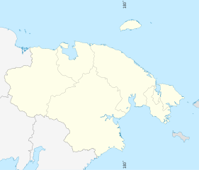
English: Chukotka_Autonomous_Okrug_location_map
Equirectangular projection, N/S stretching 256 %. True scale parallel: 67°00' N. Geographic limits of the map:
|
| Tarih | |
| Menba | Öz işi, using ETOPO data, Inkscape and GMT Tools |
| Yaratıcı | Das steinerne Herz |
Litsenziyalama
I, the copyright holder of this work, hereby publish it under the following licenses:
This file is licensed under the Creative Commons Attribution-Share Alike 3.0 Unported license.
- Azatsıñız:
- paylaşuv – qopyaluv, dağıtuv ve iletüv
- remiks etüv – uyğunlaştıruv
- Bu şartlar astında:
- attribution – You must give appropriate credit, provide a link to the license, and indicate if changes were made. You may do so in any reasonable manner, but not in any way that suggests the licensor endorses you or your use.
- aynı şekilde paylaşuv – If you remix, transform, or build upon the material, you must distribute your contributions under the same or compatible license as the original.

|
Permission is granted to copy, distribute and/or modify this document under the terms of the GNU Free Documentation License, Version 1.2 or any later version published by the Free Software Foundation; with no Invariant Sections, no Front-Cover Texts, and no Back-Cover Texts. A copy of the license is included in the section entitled GNU Free Documentation License. |
İstedigiñiz lisansnı seçebilirsiñiz.
Faylnıñ keçmişi
Faylnıñ kerekli anki alını körmek içün tarihqa/saatqa basıñız.
| Tarih ve saat | Kiçik resim | En × boy | Qullanıcı | İzaat | |
|---|---|---|---|---|---|
| şimdiki | 10:34, 2011 s. iyülniñ 30 | | 793 × 677 (314 KB) | Das steinerne Herz | corr |
| 10:32, 2011 s. iyülniñ 30 |  | 793 × 677 (314 KB) | Das steinerne Herz | {{Information |Description ={{en|1=Chukotka_Autonomous_Okrug_location_map}} |Source ={{own}} |Author =Das steinerne Herz |Date =29 July 2011 |Permission = |other_versions = }} [[Category:Maps o |
Fayl qullanıluvı
Bu 10 saifeler qullana bu fayldı:
Umumiy fayl qullanıluvı
Bu vikilerde bu fayldı qullana:
- ab.wikipedia.org qullanım
- af.wikipedia.org qullanım
- als.wikipedia.org qullanım
- ar.wikipedia.org qullanım
- az.wikipedia.org qullanım
- ba.wikipedia.org qullanım
- be.wikipedia.org qullanım
- bg.wikipedia.org qullanım
- bn.wikipedia.org qullanım
- ceb.wikipedia.org qullanım
- ce.wikipedia.org qullanım
- Беринговски
- Кеп:Меттиган карта Росси Чукчийн автономин гуо
- Угольные Копи
- Алькатваам (эвла)
- Снежни (Чукчийн автономин гуо)
- Шахтёрски (Чукчийн автономин гуо)
- Хатырка (эвла)
- Мейныпильгыно
- Ламутски
- Краснено
- Усть-Белая
- Отрожни (Чукчийн автономин гуо)
- Берёзово (Чукчийн автономин гуо)
- Тамватней
- Зареченск (Чукчийн автономин гуо)
- Билибино
View more global usage of this file.