
Fayl:Outline Map of Sakhalin Oblast.svg

Size of this PNG preview of this SVG file: 499 × 599 pixels. Başqa çözüm: 200 × 240 pixels | 400 × 480 pixels | 640 × 768 pixels | 853 × 1.024 pixels | 1.706 × 2.048 pixels | 1.127 × 1.353 pixels.
Kerçek fayl (SVG faylı, nominal 1.127 × 1.353 piksel, fayl büyükligi: 110 KB)
Faylğa ait qısqa tarif
| Tasvir |
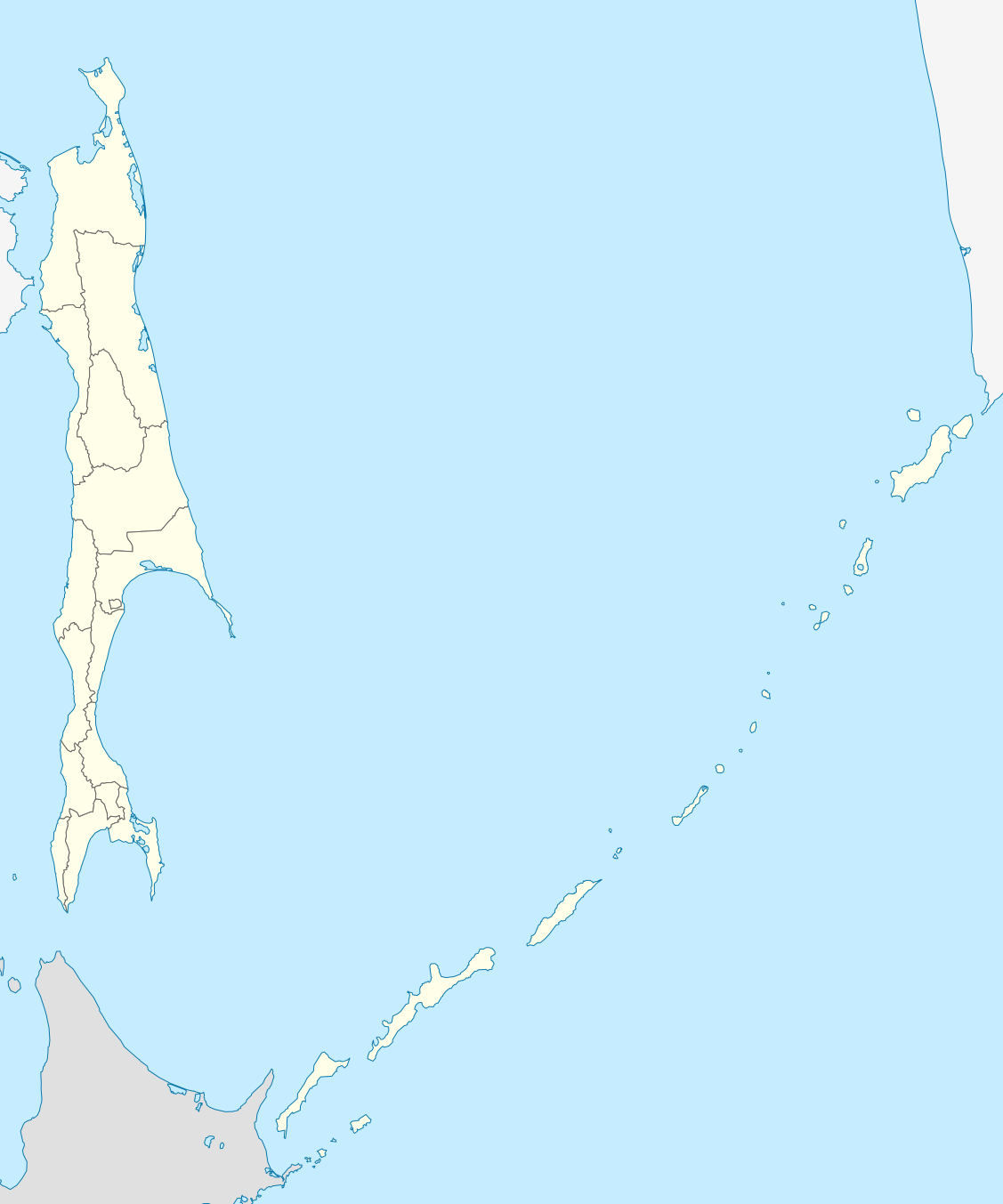
Русский: Позиционная карта Сахалинской области Равноугольная проекция, растяжение - 160%. Координаты краёв:
|
| Tarih | |
| Menba |
Öz işi This W3C-unspecified vector image was created with Inkscape . |
| Yaratıcı | Виктор В |
| Other versions |
[]
|

.svg)

Litsenziyalama
I, the copyright holder of this work, hereby publish it under the following license:
| I, the copyright holder of this work, release this work into the public domain. This applies worldwide. In some countries this may not be legally possible; if so: I grant anyone the right to use this work for any purpose, without any conditions, unless such conditions are required by law. |
Faylnıñ keçmişi
Faylnıñ kerekli anki alını körmek içün tarihqa/saatqa basıñız.
| Tarih ve saat | Kiçik resim | En × boy | Qullanıcı | İzaat | |
|---|---|---|---|---|---|
| şimdiki | 22:34, 2010 s. fevralniñ 22 | | 1.127 × 1.353 (110 KB) | Виктор В | == {{int:filedesc}} == {{Information |Description={{ru|1=Позиционная карта Сахалинской области<br>Равноугольная проекция, растяжение - 160%. Координаты краёв: * север - 5 |
Fayl qullanıluvı
Bu 21 saifeler qullana bu fayldı:
- Aleksandrovsk-Sahalinskiy
- Aniva (şeer)
- Dolinsk
- Holmsk
- Korsakov (şeer)
- Kurilsk
- Makarov (şeer)
- Nevelsk
- Nogliki
- Oha
- Poronaysk
- Severo-Kurilsk
- Smirnıh
- Tomari (Rusiye)
- Tımovskoye
- Uglegorsk (Sahalin vilâyeti)
- Vahruşev (şeer şeklinde qasaba)
- Yujno-Kurilsk
- Yujno-Sahalinsk
- Şahtörsk (Rusiye)
- Şablon:Location map Rusiye Sahalin vilâyeti
Umumiy fayl qullanıluvı
Bu vikilerde bu fayldı qullana:
- af.wikipedia.org qullanım
- ar.wikipedia.org qullanım
- az.wikipedia.org qullanım
- be-tarask.wikipedia.org qullanım
- be.wikipedia.org qullanım
- bg.wikipedia.org qullanım
- ceb.wikipedia.org qullanım
- ce.wikipedia.org qullanım
- Южно-Сахалинск
- Кеп:Меттиган карта Росси Сахалинан область
- Анива (гӀала)
- Благовещенски (Сахалинан область)
- Воскресенски (Сахалинан область)
- Высоки (Сахалинан область)
- Зеленодольск (Сахалинан область)
- Мицулевка
- Новотроицки (Сахалинан область)
- Огоньки (Сахалинан область)
- Песчански (Сахалинан область)
- Петропавловски (Сахалинан область)
- Рыбацки (Сахалинан область)
- Таранай
- Троицки (Сахалинан область)
- Успенски (Сахалинан область)
- Арсентьевка (Сахалинан область)
- Быков (Сахалинан область)
- Взморье (Сахалинан область)
- Долинск
- Октябрьски (Сахалинан область)
- Покровка (Сахалинан область)
View more global usage of this file.