
Fayl:Outline Map of North Ossetia.svg

Size of this PNG preview of this SVG file: 550 × 599 pixels. Başqa çözüm: 220 × 240 pixels | 441 × 480 pixels | 705 × 768 pixels | 940 × 1.024 pixels | 1.881 × 2.048 pixels | 1.000 × 1.089 pixels.
Kerçek fayl (SVG faylı, nominal 1.000 × 1.089 piksel, fayl büyükligi: 46 KB)
Faylğa ait qısqa tarif
| Tasvir |
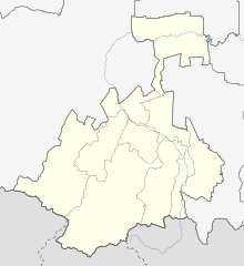
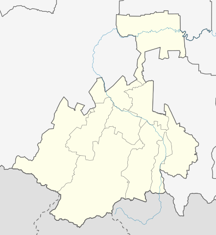
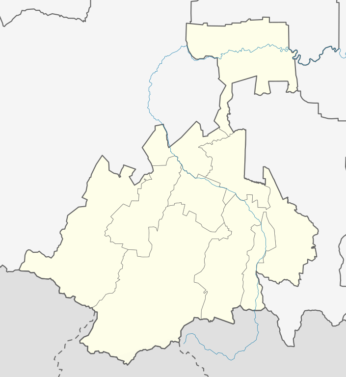
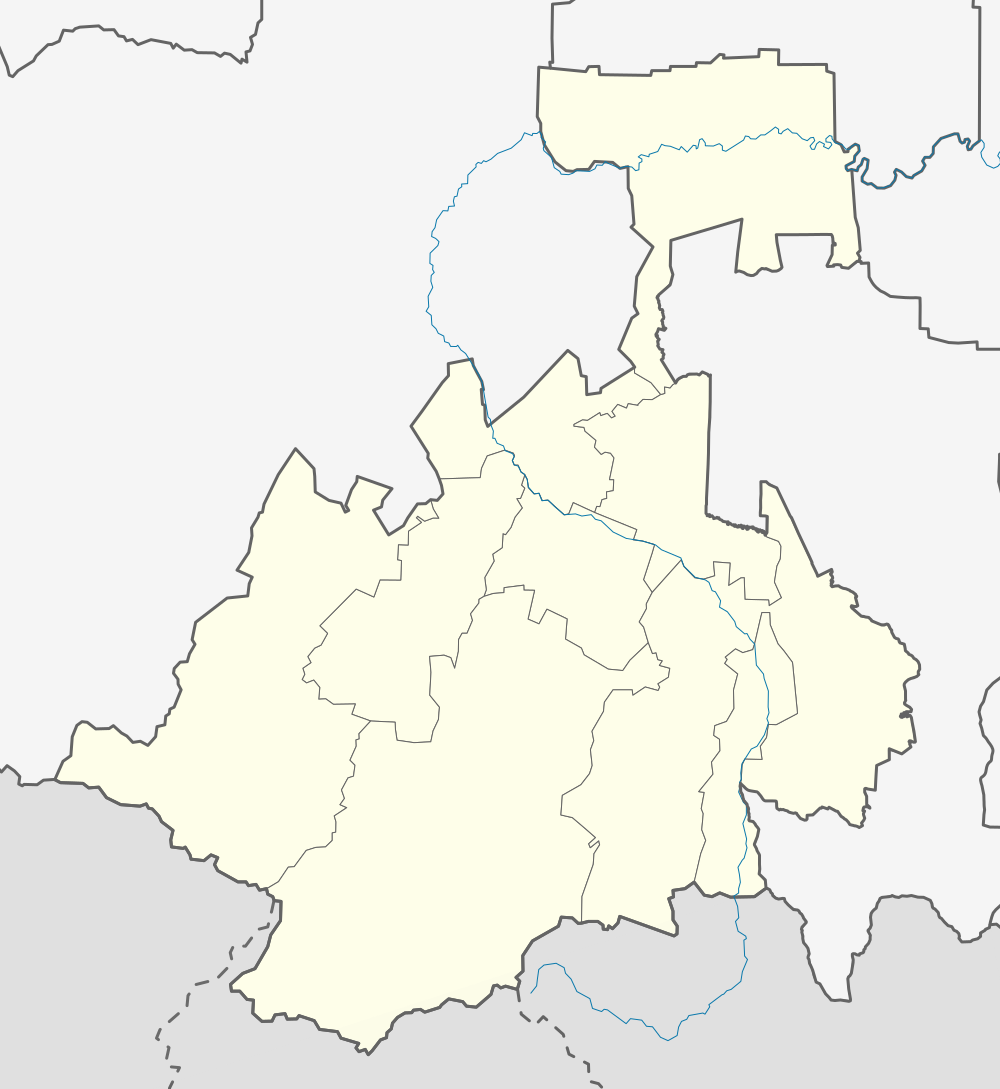
Русский: Позиционная карта Республики Северная Осетия-Алания Равноугольная проекция. Координаты краёв:
|
| Tarih | |
| Menba |
Öz işi This W3C-unspecified vector image was created with Inkscape . |
| Yaratıcı | Виктор В |
| Other versions |
[] |


Litsenziyalama
| I, the copyright holder of this work, release this work into the public domain. This applies worldwide. In some countries this may not be legally possible; if so: I grant anyone the right to use this work for any purpose, without any conditions, unless such conditions are required by law. |
Faylnıñ keçmişi
Faylnıñ kerekli anki alını körmek içün tarihqa/saatqa basıñız.
| Tarih ve saat | Kiçik resim | En × boy | Qullanıcı | İzaat | |
|---|---|---|---|---|---|
| şimdiki | 13:34, 2020 s. fevralniñ 22 | | 1.000 × 1.089 (46 KB) | Takhirgeran Umar | уточнение |
| 04:34, 2010 s. avgustnıñ 16 |  | 1.000 × 1.089 (28 KB) | Виктор В | == {{int:filedesc}} == {{Information |Description={{ru|1=Позиционная карта Республики Северная Осетия-Алания<br\>Равноугольная проекция. Координаты краёв: * север — 4 |
Fayl qullanıluvı
Bu 11 saifeler qullana bu fayldı:
Umumiy fayl qullanıluvı
Bu vikilerde bu fayldı qullana:
- af.wikipedia.org qullanım
- ar.wikipedia.org qullanım
- azb.wikipedia.org qullanım
- ba.wikipedia.org qullanım
- be.wikipedia.org qullanım
- bg.wikipedia.org qullanım
- ceb.wikipedia.org qullanım
- ce.wikipedia.org qullanım
- БуритӀе
- Кеп:Меттиган карта Росси Къилбаседа ХӀирийчоь
- Алагир
- Ардон (гӀала)
- Дигора
- Чикола
- Эльхотово
- Мазалк
- Берса-Йурт
- Шолхи
- Абайтикау
- Архон (Къилбаседа ХӀирийчоь)
- Барзикау
- Биз (Къилбаседа ХӀирийчоь)
- Бурон
- Варце
- Верхни Бирагзанг
- Верхни Зарамаг
- Верхни Згид
- Верхни Унал
- Верхни Фиагдон
- Верхни Цей
- Галон (Къилбаседа ХӀирийчоь)
- Горни Карца
- Гусыра
- Дагом
- Дайкау
- Даллагкау
- Дзивгис
- Дзуарикау
- Донисар
- Елгона
- Ецина
- Згил
- Зинцар
View more global usage of this file.