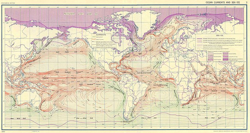
Fayl:Ocean currents 1943.jpg

Size of this preview: 800 × 426 pixels. Başqa çözüm: 320 × 170 pixels | 640 × 341 pixels | 1.024 × 546 pixels | 1.280 × 682 pixels | 2.639 × 1.406 pixels.
Kerçek fayl (2.639 × 1.406 piksel, fayl büyükligi: 5,14 MB, MIME çeşiti: image/jpeg)
Faylnıñ keçmişi
Faylnıñ kerekli anki alını körmek içün tarihqa/saatqa basıñız.
| Tarih ve saat | Kiçik resim | En × boy | Qullanıcı | İzaat | |
|---|---|---|---|---|---|
| şimdiki | 10:58, 2016 s. sentâbrniñ 6 |  | 2.639 × 1.406 (5,14 MB) | Dencey | new |
| 20:20, 2005 s. martnıñ 31 |  | 2.639 × 1.406 (582 KB) | SEWilco | '''Ocean Currents and Sea Ice from Atlas of World Maps.''' United States Army Service Forces, Army Specialized Training Division. Army Service Forces Manual M-101. 1943 {{PD-PCL}} Source: http://www.lib.utexas.edu/maps/world_maps/ocean_currents_ |
Fayl qullanıluvı
Bu faylnı qullanğan saife yoq.
Umumiy fayl qullanıluvı
Bu vikilerde bu fayldı qullana:
- bn.wikipedia.org qullanım
- cs.wikipedia.org qullanım
- de.wikipedia.org qullanım
- en.wikipedia.org qullanım
- eo.wikipedia.org qullanım
- es.wikipedia.org qullanım
- eu.wikipedia.org qullanım
- fr.wikipedia.org qullanım
- fr.wiktionary.org qullanım
- hu.wikipedia.org qullanım
- it.wikipedia.org qullanım
- ja.wikipedia.org qullanım
- lt.wikipedia.org qullanım
- nn.wikipedia.org qullanım
- oc.wikipedia.org qullanım
- pt.wiktionary.org qullanım
- sk.wikipedia.org qullanım
- sl.wikipedia.org qullanım
- sv.wikipedia.org qullanım
- tr.wikipedia.org qullanım
- vi.wikipedia.org qullanım
- zh.wikipedia.org qullanım


