
Fayl:Map korea german labels.png
Size of this preview: 502 × 599 pixels. Başqa çözüm: 201 × 240 pixels | 402 × 480 pixels | 652 × 778 pixels.
Kerçek fayl (652 × 778 piksel, fayl büyükligi: 505 KB, MIME çeşiti: image/png)
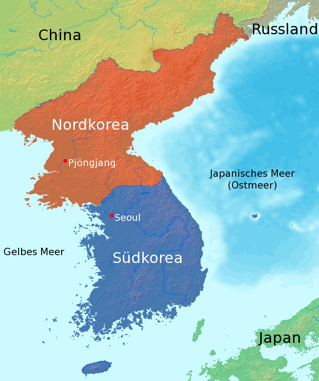
| Tasvir | Map of the devided Korea with German labels |
| Tarih | |
| Menba | Map by demis.nl (which is according to Image:Sea of Japan Map.png public domain), edited by myself |
| Yaratıcı | Johannes Barre (IGEL) |
| Other versions | Image:map_korea_without_labels.png |

|
Permission is granted to copy, distribute and/or modify this document under the terms of the GNU Free Documentation License, Version 1.2 or any later version published by the Free Software Foundation; with no Invariant Sections, no Front-Cover Texts, and no Back-Cover Texts. A copy of the license is included in the section entitled GNU Free Documentation License. |
| This file is licensed under the Creative Commons Attribution-Share Alike 3.0 Unported license. | ||
| ||
| This licensing tag was added to this file as part of the GFDL licensing update. |
Faylnıñ keçmişi
Faylnıñ kerekli anki alını körmek içün tarihqa/saatqa basıñız.
| Tarih ve saat | Kiçik resim | En × boy | Qullanıcı | İzaat | |
|---|---|---|---|---|---|
| şimdiki | 15:07, 2014 s. fevralniñ 15 | | 652 × 778 (505 KB) | Seoulmann | Reverted to version as of 23:51, 1 October 2008 |
| 15:07, 2014 s. fevralniñ 15 |  | 652 × 778 (505 KB) | Seoulmann | Reverted to version as of 23:51, 1 October 2008 | |
| 22:16, 2009 s. yanvarniñ 29 |  | 536 × 778 (415 KB) | Valentim | Neuerstellung der Karte mit neuer, deutscher Namensgebung nach http://de.wikipedia.org/wiki/Wikipedia:Namensgebung#Anderssprachige_Gebiete | |
| 23:51, 2008 s. oktâbrniñ 1 |  | 652 × 778 (505 KB) | Valentim | Reverted to version as of 23:46, 1 October 2008 (because of because of http://de.wikipedia.org/wiki/Wikipedia:Namensgebung#Anderssprachige_Gebiete) | |
| 23:50, 2008 s. oktâbrniñ 1 |  | 652 × 778 (505 KB) | Valentim | Reverted to version as of 08:49, 6 June 2005 (because of http://de.wikipedia.org/wiki/Wikipedia:Namensgebung#Anderssprachige_Gebiete) | |
| 23:46, 2008 s. oktâbrniñ 1 |  | 652 × 778 (505 KB) | Valentim | Reverted to version as of 08:49, 6 June 2005 (because of http://de.wikipedia.org/wiki/Wikipedia:Namensgebung#Anderssprachige_Gebiete) | |
| 21:39, 2005 s. iyünniñ 29 |  | 652 × 778 (505 KB) | IGEL | Ostmeer und Japanisches Meer getauscht | |
| 08:49, 2005 s. iyünniñ 6 |  | 652 × 778 (505 KB) | IGEL | {{Information| |Description = Map of the devided Korea with German labels |Source = Map by [http://www2.demis.nl/mapserver/mapper.asp demis.nl] (which is according to Image:Sea of Japan Map.png public domain), edited by myself |Date = Created 2005-0 |
Fayl qullanıluvı
Bu saife qullana bu fayldı:
Umumiy fayl qullanıluvı
Bu vikilerde bu fayldı qullana:
- als.wikipedia.org qullanım
- be.wikipedia.org qullanım
- bo.wikipedia.org qullanım
- de.wikipedia.org qullanım
- de.wikibooks.org qullanım
- de.wikinews.org qullanım
- de.wikiversity.org qullanım
- de.wiktionary.org qullanım
- nds.wikipedia.org qullanım
- pag.wikipedia.org qullanım