
Fayl:Portugal location map.svg

Size of this PNG preview of this SVG file: 313 × 600 pixels. Başqa çözüm: 125 × 240 pixels | 250 × 480 pixels | 400 × 768 pixels | 534 × 1.024 pixels | 1.068 × 2.048 pixels | 612 × 1.173 pixels.
Kerçek fayl (SVG faylı, nominal 612 × 1.173 piksel, fayl büyükligi: 211 KB)
Oi a cidade de Vizeu .
Faylğa ait qısqa tarif
| Tasvir |
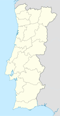
Deutsch: Positionskarte von Portugal
Quadratische Plattkarte, N-S-Streckung 130 %. Geographische Begrenzung der Karte:
English: Location map of Portugal
Equirectangular projection, N/S stretching 130 %. Geographic limits of the map:
Español: Mapa de Portugal con los 18 distritos delimitados
Proyección cilíndrica equidistante, N/S alargamiento 130 %. Límites geográficos del mapa:
Português: Mapa de Portugal com os 18 distritos delimitados, para uso em localizações geográficas
Projecção cilíndrica equidistante, N/S alongamento 130 %. Limites geográficos do mapa:
|
| Tarih | 03-07-2008 |
| Menba | own work, using United States National Imagery and Mapping Agency data |
| Yaratıcı | NordNordWest |
| Other versions |
Derivative works of this file: |

|
This map has been made or improved in the German Kartenwerkstatt (Map Lab). You can propose maps to improve as well.
|
Litsenziyalama
I, the copyright holder of this work, hereby publish it under the following licenses:

|
Permission is granted to copy, distribute and/or modify this document under the terms of the GNU Free Documentation License, Version 1.2 or any later version published by the Free Software Foundation; with no Invariant Sections, no Front-Cover Texts, and no Back-Cover Texts. A copy of the license is included in the section entitled GNU Free Documentation License. |
This file is licensed under the Creative Commons Attribution-Share Alike 3.0 Unported license.
- Azatsıñız:
- paylaşuv – qopyaluv, dağıtuv ve iletüv
- remiks etüv – uyğunlaştıruv
- Bu şartlar astında:
- attribution – You must give appropriate credit, provide a link to the license, and indicate if changes were made. You may do so in any reasonable manner, but not in any way that suggests the licensor endorses you or your use.
- aynı şekilde paylaşuv – If you remix, transform, or build upon the material, you must distribute your contributions under the same or compatible license as the original.
İstedigiñiz lisansnı seçebilirsiñiz.
Faylnıñ keçmişi
Faylnıñ kerekli anki alını körmek içün tarihqa/saatqa basıñız.
| Tarih ve saat | Kiçik resim | En × boy | Qullanıcı | İzaat | |
|---|---|---|---|---|---|
| şimdiki | 08:27, 2008 s. avgustnıñ 29 | | 612 × 1.173 (211 KB) | NordNordWest | |
| 18:29, 2008 s. avgustnıñ 11 |  | 306 × 586 (207 KB) | NordNordWest | ||
| 22:01, 2008 s. iyülniñ 2 |  | 306 × 586 (236 KB) | NordNordWest | {{Information |Description= {{de|Positionskarte von Portugal}} Quadratische Plattkarte, N-S-Streckung 130 %. Geographische Begrenzung der Karte: * N: 42.3° N * S: 36.7° N * W: 9.8° W * O: 6.0° W {{en|Location map of [[:en:Portugal|Por |
Fayl qullanıluvı
Bu 2 saifeler qullana bu fayldı:
Umumiy fayl qullanıluvı
Bu vikilerde bu fayldı qullana:
- af.wikipedia.org qullanım
- als.wikipedia.org qullanım
- am.wikipedia.org qullanım
- an.wikipedia.org qullanım
- Sacavém
- Lisbona
- Ericeira
- Mafra
- Sintra
- Braga
- Coimbra
- Évora
- Aveiro
- Guarda (Portugal)
- Leiria
- Setúbal
- Almada (Portugal)
- Miranda de l Douro
- Bumioso
- Sines
- Porto
- Estádio do Dragão
- Seu de Porto
- Cascais
- Guimarães
- Lousã
- Miranda do Corvo
- Pampilhosa da Serra
- Vila Nova de Gaia
- Pavilhão João Rocha
- Elvas
- Ponte de Sor
- Portalegre
- Plantilla:Mapa de localización Portugal
- ar.wikipedia.org qullanım
- az.wikipedia.org qullanım
View more global usage of this file.