
Fayl:Outline Map of Buryatia.svg

Size of this PNG preview of this SVG file: 800 × 556 pixels. Başqa çözüm: 320 × 222 pixels | 640 × 445 pixels | 1.024 × 712 pixels | 1.280 × 890 pixels | 2.560 × 1.779 pixels | 1.361 × 946 pixels.
Kerçek fayl (SVG faylı, nominal 1.361 × 946 piksel, fayl büyükligi: 153 KB)
Faylğa ait qısqa tarif
| Tasvir |
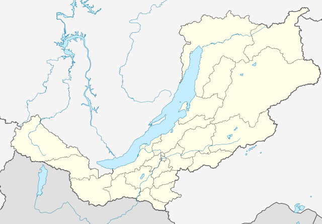
Русский: Позиционная карта Бурятии Равноугольная проекция, растяжение — 165%. Координаты краёв:
|
| Tarih | |
| Menba |
Öz işi This W3C-unspecified vector image was created with Inkscape . |
| Yaratıcı | Виктор В |
| Other versions |
Derivative works of this file: Outline Map of Buryatia (with position on the Map of Russia).svg
[] |

.svg)

Litsenziyalama
| I, the copyright holder of this work, release this work into the public domain. This applies worldwide. In some countries this may not be legally possible; if so: I grant anyone the right to use this work for any purpose, without any conditions, unless such conditions are required by law. |
Faylnıñ keçmişi
Faylnıñ kerekli anki alını körmek içün tarihqa/saatqa basıñız.
| Tarih ve saat | Kiçik resim | En × boy | Qullanıcı | İzaat | |
|---|---|---|---|---|---|
| şimdiki | 19:07, 2010 s. martnıñ 13 | | 1.361 × 946 (153 KB) | Виктор В | == {{int:filedesc}} == {{Information |Description={{ru|1=Позиционная карта Бурятии<br>Равноугольная проекция, растяжение — 165%. Координаты краёв: * север — 57.5° С * юг — |
Fayl qullanıluvı
Bu 34 saifeler qullana bu fayldı:
- Babuşkin (Burât Ulusı)
- Bagdarin
- Barguzin (köy)
- Biçura (Burât Ulusı)
- Gusinoozörsk
- Horinsk
- Kabansk
- Kamensk (Burât Ulusı)
- Kijinga
- Kiçera
- Kurumkan
- Kâhta
- Kıren
- Muhorşibir
- Nauşki
- Nijneangarsk
- Novıy Uoyan
- Onohoy
- Orlik (Burât Ulusı)
- Petropavlovka (Cida rayonı)
- Selenginsk
- Severobaykalsk
- Severomuysk
- Sosnovo-Ozörskoye
- Taksimo
- Tarbagatay (Tarbagatay rayonı)
- Turuntayevo (Burât Ulusı)
- Ulan-Ude
- Ust-Barguzin
- Yançukan
- Zaigrayevo
- Zakamensk
- İvolginsk
- Şablon:Location map Rusiye Burât Ulusı
Umumiy fayl qullanıluvı
Bu vikilerde bu fayldı qullana:
- af.wikipedia.org qullanım
- az.wikipedia.org qullanım
- ba.wikipedia.org qullanım
- be.wikipedia.org qullanım
- Закаменск
- Кяхта
- Улан-Удэ
- Гусінаазёрск
- Бабушкін
- Северабайкальск
- Шаблон:На карце/Расія Бурація
- Новы Уаян
- Ніжнеангарск
- Багдарын
- Кырэн
- Таксіма
- Кічэра
- Хорынск
- Бічура (Бурація)
- Баргузін (сяло)
- Усць-Баргузін
- Анахой
- Янчукан
- Селенгінск
- Наушкі
- Каменск (Бурація)
- Заіграева
- Кабанск
- Івалгінск
- Танхой
- Джыда (Бурація)
- Петрапаўлаўка (Джыдзінскі раён)
- Курумкан
- Орлік (Бурація)
- Гусінае Возера
- Северамуйск
- Тарбагатай (Тарбагатайскі раён)
- Кіжынга
- Мухаршыбір
- Турунтаева (Бурація)
- Саснова-Азёрскае
- Баянгол (Закаменскі раён)
- Ганзурына (пасёлак пры станцыі)
- Ангір (Заіграеўскі раён)
- Анахой-Шыбір
- Дабата
- Дабо-Ёнхар
- bxr.wikipedia.org qullanım
- ce.wikipedia.org qullanım
View more global usage of this file.