
Fayl:Map of Russia - Jewish Autonomous Oblast (Crimea disputed).svg

Size of this PNG preview of this SVG file: 800 × 440 pixels. Başqa çözüm: 320 × 176 pixels | 640 × 352 pixels | 1.024 × 563 pixels | 1.280 × 704 pixels | 2.560 × 1.407 pixels | 1.541 × 847 pixels.
Kerçek fayl (SVG faylı, nominal 1.541 × 847 piksel, fayl büyükligi: 574 KB)
.svg)
Faylğa ait qısqa tarif
| Tasvir |
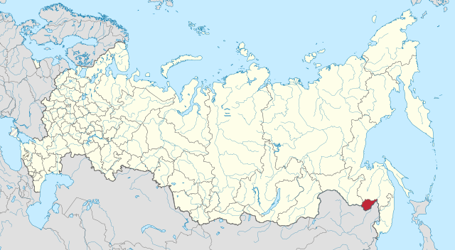
Русский: Еврейская автономная область на карте России (с выделением Крыма в качестве спорного) |
| Tarih | |
| Menba |
This file was derived from: |
| Yaratıcı |
|
.svg)
| This is a retouched picture, which means that it has been digitally altered from its original version. Modifications: Hatched Crimea. The original can be viewed here: Map of Russia - Chechnya (Crimea disputed).svg:
|
Litsenziyalama
This file is licensed under the Creative Commons Attribution-Share Alike 3.0 Unported license.
- Azatsıñız:
- paylaşuv – qopyaluv, dağıtuv ve iletüv
- remiks etüv – uyğunlaştıruv
- Bu şartlar astında:
- attribution – You must give appropriate credit, provide a link to the license, and indicate if changes were made. You may do so in any reasonable manner, but not in any way that suggests the licensor endorses you or your use.
- aynı şekilde paylaşuv – If you remix, transform, or build upon the material, you must distribute your contributions under the same or compatible license as the original.
Original upload log
This image is a derivative work of the following images:
- File:Map of Russia - Jewish Autonomous Oblast.svg licensed with Cc-by-sa-4.0
- 2015-04-22T00:47:26Z Stasyan117 1541x847 (6883834 Bytes) User created page with UploadWizard
- File:Map of Russia - Chechnya (Crimea disputed).svg licensed with Cc-by-sa-4.0
Uploaded with derivativeFX
Faylnıñ keçmişi
Faylnıñ kerekli anki alını körmek içün tarihqa/saatqa basıñız.
| Tarih ve saat | Kiçik resim | En × boy | Qullanıcı | İzaat | |
|---|---|---|---|---|---|
| şimdiki | 20:21, 2023 s. yanvarniñ 14 | | 1.541 × 847 (574 KB) | Mellk | Reverted to version as of 11:04, 26 May 2020 (UTC) |
| 07:55, 2022 s. oktâbrniñ 4 |  | 1.541 × 847 (6,59 MB) | President Loki | fixed mistake | |
| 23:26, 2022 s. oktâbrniñ 3 |  | 1.541 × 847 (6,58 MB) | President Loki | Added disputed Luhansk, Donetsk, Kherson and Zaporizhzhia | |
| 11:04, 2020 s. mayısnıñ 26 |  | 1.541 × 847 (574 KB) | Seryo93 | Removed embedded raster layer, to make file more lightweight | |
| 10:52, 2020 s. mayısnıñ 26 |  | 1.541 × 847 (6,57 MB) | Seryo93 | == {{int:filedesc}} == {{Information |Description={{ru|1=Еврейская автономная область на карте России (с выделением Крыма в качестве спорного)}} |date=2020-05-26 |Source={{Derived from|Map of Russia - Jewish Autonomous Oblast.svg|Map of Russia - Chechnya (Crimea disputed).svg|display=50}} |Date=2020-05-26 10:49 (UTC) |Author=* File:Map of Russia - Jewish Autonomous Oblast.svg: Stasyan117 * [[:File:Map of Russia - Chech... |
Fayl qullanıluvı
Bu saife qullana bu fayldı:
Umumiy fayl qullanıluvı
Bu vikilerde bu fayldı qullana:
- ar.wikipedia.org qullanım
- arz.wikipedia.org qullanım
- ast.wikipedia.org qullanım
- az.wikipedia.org qullanım
- be.wikipedia.org qullanım
- bxr.wikipedia.org qullanım
- ca.wikipedia.org qullanım
- ce.wikipedia.org qullanım
- da.wikipedia.org qullanım
- el.wikipedia.org qullanım
- en.wikipedia.org qullanım
- es.wikipedia.org qullanım
- fa.wikipedia.org qullanım
- fy.wikipedia.org qullanım
- ga.wikipedia.org qullanım
- gl.wikipedia.org qullanım
- hy.wikipedia.org qullanım
- kv.wikipedia.org qullanım
- la.wikipedia.org qullanım
- lld.wikipedia.org qullanım
- lv.wikipedia.org qullanım
- ml.wikipedia.org qullanım
- myv.wikipedia.org qullanım
- mzn.wikipedia.org qullanım
- nds.wikipedia.org qullanım
- os.wikipedia.org qullanım
- ru.wikipedia.org qullanım
- sl.wikipedia.org qullanım
- sr.wikipedia.org qullanım
- tg.wikipedia.org qullanım
- th.wikipedia.org qullanım
- tl.wikipedia.org qullanım
- tt.wikipedia.org qullanım
View more global usage of this file.
.svg)
.svg)