
Fayl:Laufener Hütte (Juni 2012).JPG

Size of this preview: 800 × 531 pixels. Başqa çözüm: 320 × 213 pixels | 640 × 425 pixels | 1.024 × 680 pixels | 1.280 × 850 pixels | 2.560 × 1.700 pixels | 4.288 × 2.848 pixels.
Kerçek fayl (4.288 × 2.848 piksel, fayl büyükligi: 10,3 MB, MIME çeşiti: image/jpeg)
.JPG)
Faylğa ait qısqa tarif
| Tasvir |
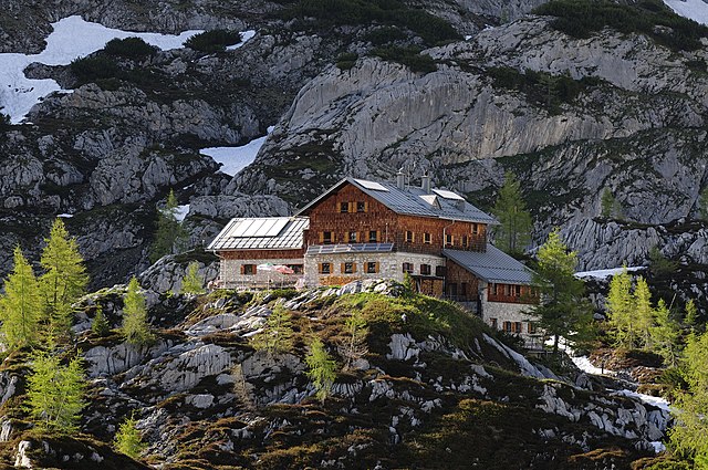
Deutsch: Südliche Ansicht der Laufener Hütte
English: Southern view of the Laufen Hut
Русский: Вид хижины Лауфен с юга, Зальцбург, Австрия
Македонски: Јужен поглед на планинскиот дом „Лауфнер“ на Северни Варовнички Алпи, Австрија.
Nederlands: Het zuidelijke aangezicht van de Laufener Hütte, gelegen op een hoogte van 1.726 meter in het Tennengebirge aan de voet van de Fritzerkogel in de Oostenrijkse deelstaat Salzburg.
中文(简体):北莱姆斯通阿尔卑斯山脉特内恩山脉上的小屋。 |
| Tarih | |
| Menba | picture taken by Philipp Weigell |
| Yaratıcı | Philipp Weigell |
| İzin (Faylnı yañıdan qullanuv) |
English: Please report references to spam@lagrada.de. Deutsch: Quellenangabe und Beleg an spam@lagrada.de erbeten. Español: Por favor mandar informaciones sobre el uso a spam@lagrada.de. |
| Other versions | Derivative works of this file: Laufener Hütte (Juni 2012) cropped.JPG |
_cropped.JPG)
| Camera location | | View this and other nearby images on: OpenStreetMap |
|---|
.JPG¶ms=047.520425_N_0013.336410_E_globe:Earth_type:camera__&language=crh)
Assessment
|
.JPG)
This image was selected as picture of the day on Wikimedia Commons for 10 July 2012. It was captioned as follows: Other languages:
Deutsch: Südliche Ansicht der Laufener Hütte. Nederlands: Het zuidelijke aangezicht van de Laufener Hütte, gelegen op een hoogte van 1.726 meter in het Tennengebirge aan de voet van de Fritzerkogel in de Oostenrijkse deelstaat Salzburg. Македонски: Јужен поглед на планинскиот дом „Лауфнер“ на Северни Варовнички Алпи, Австрија. 中文: 北莱姆斯通阿尔卑斯山脉特内恩山脉上的小屋。 |
Litsenziyalama
This file is licensed under the Creative Commons Attribution 3.0 Unported license.
- Azatsıñız:
- paylaşuv – qopyaluv, dağıtuv ve iletüv
- remiks etüv – uyğunlaştıruv
- Bu şartlar astında:
- attribution – You must give appropriate credit, provide a link to the license, and indicate if changes were made. You may do so in any reasonable manner, but not in any way that suggests the licensor endorses you or your use.
Faylnıñ keçmişi
Faylnıñ kerekli anki alını körmek içün tarihqa/saatqa basıñız.
| Tarih ve saat | Kiçik resim | En × boy | Qullanıcı | İzaat | |
|---|---|---|---|---|---|
| şimdiki | 18:28, 2012 s. iyünniñ 9 | | 4.288 × 2.848 (10,3 MB) | Morray |
Fayl qullanıluvı
Bu saife qullana bu fayldı:
Umumiy fayl qullanıluvı
Bu vikilerde bu fayldı qullana:
- be-tarask.wikipedia.org qullanım
- bg.wikipedia.org qullanım
- bn.wikipedia.org qullanım
- cv.wikipedia.org qullanım
- de.wikipedia.org qullanım
- Laufener Hütte
- Wikipedia:Exzellente Bilder/Kunst und Kultur
- Datei:Laufener Hütte (Juni 2012).JPG
- Wikipedia:Kandidaten für exzellente Bilder/Archiv2012/10
- Benutzer:Morray
- Benutzer:Tkarcher/Wikidata Liste der DAV Hütten
- Liste der Hütten des Deutschen Alpenvereins
- Wikipedia:WikiProjekt Österreich/WD/Hallein
- Wikipedia:Projekt WikiAlpenforum (WAF)/Artikelwunsch Alpenverein/Schutzhütten nach Gebirgszug
- Wikipedia:Projekt WikiAlpenforum (WAF)/Artikelwunsch Alpenverein/Schutzhütten nach Verwaltungseinheit
- en.wikipedia.org qullanım
- es.wikivoyage.org qullanım
- hi.wiktionary.org qullanım
- hu.wikipedia.org qullanım
- it.wikipedia.org qullanım
- ka.wikipedia.org qullanım
- kk.wikipedia.org qullanım
- ko.wikipedia.org qullanım
- krc.wikipedia.org qullanım
- lbe.wikipedia.org qullanım
- mg.wikipedia.org qullanım
- nl.wikipedia.org qullanım
- os.wikipedia.org qullanım
- pt.wikipedia.org qullanım
- ru.wikipedia.org qullanım
- ru.wikinews.org qullanım
- sah.wikipedia.org qullanım
- tt.wikipedia.org qullanım
- uk.wikipedia.org qullanım
- www.wikidata.org qullanım
- xal.wikipedia.org qullanım
- zh.wikipedia.org qullanım
.JPG)
.JPG)