
Fayl:Berlin Hufeisensiedlung UAV 04-2017.jpg
Size of this preview: 799 × 599 pixels. Başqa çözüm: 320 × 240 pixels | 640 × 480 pixels | 1.024 × 768 pixels | 1.280 × 960 pixels | 2.560 × 1.920 pixels | 3.573 × 2.680 pixels.
Kerçek fayl (3.573 × 2.680 piksel, fayl büyükligi: 5,54 MB, MIME çeşiti: image/jpeg)
| Tasvir |
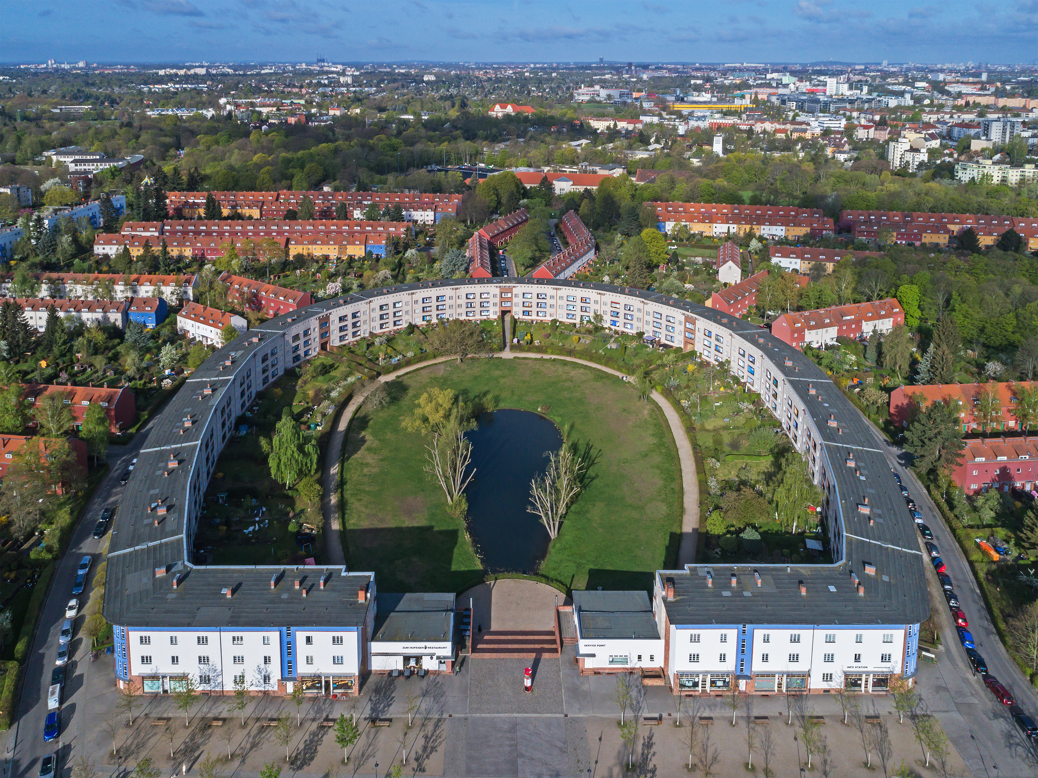
English: Aerial view of the «Horseshoe Block» in Berlin (Germany), looking west
Español: Vista aérea de la «herradura», una urbanización diseñada por el arquitecto Bruno Taut en Berlín, Alemania.
Deutsch: Luftaufnahme der Hufeisensiedlung in Berlin (Deutschland) mit Blickrichtung Westen
Polski: Widok z powietrza na zaprojektowane przez Bruno Tauta Osiedle Podkowy (niem. Hufeisensiedlung) w Berlinie, w Niemczech.
Русский: Аэрофотосъёмка «Дома-подковы» в Берлине (Германия) |
| Tarih | |
| Menba | Öz işi |
| Yaratıcı | A.Savin |
| İzin (Faylnı yañıdan qullanuv) |
.svg) Just attribute the author: «A.Savin, Wikipedia»; if you have questions — Telegram, or e-mail to wikiphotospace@gmail.com..svg) Просто укажите в качестве автора: «А.Савин, Википедия»; если есть вопрос — телеграм, или эл.почта на wikiphotospace@gmail.com. Kennzeichnen Sie einfach als Autor: «A.Savin, Wikipedia»; falls Sie Fragen haben — Telegram, oder E-Mail an wikiphotospace@gmail.com.
Thank you. |
| Camera location | | View this and other nearby images on: OpenStreetMap |
|---|
|
This image was selected as picture of the day on Wikimedia Commons for 29 November 2018. It was captioned as follows: Other languages:
Español: Vista aérea de la «herradura», una urbanización diseñada por el arquitecto Bruno Taut en Berlín, Alemania. Italiano: Vista aerea dell'Hufeisensiedlung ("insediamento a ferro di cavallo"), un grande complesso residenziale di Berlino progettato da Bruno Taut. Nederlands: De Hufeisensiedlung (Hoefijzernederzetting) van Bruno Taut in de Duitse hoofdstad Berlijn Polski: Widok z powietrza na zaprojektowane przez Bruno Tauta Osiedle Podkowy (niem. Hufeisensiedlung) w Berlinie, w Niemczech. Português: Vista aérea da "Ferradura" (Hufeisensiedlung), um assentamento de habitação social construído entre 1925 e 1933 em várias fases e projetado pelo arquiteto Bruno Taut em Berlim, Alemanha. Македонски: Станбениот комплекс „Потковица“ во Берлин — дело на Бруно Таут проектирано во 1920-тите. فارسی : persian |
| Annotations | This image is annotated: View the annotations at Commons |
Litsenziyalama
| Copyleft: This work of art is free; you can redistribute it and/or modify it according to terms of the Free Art License. You will find a specimen of this license on the Copyleft Attitude site as well as on other sites. |
Faylnıñ keçmişi
Faylnıñ kerekli anki alını körmek içün tarihqa/saatqa basıñız.
| Tarih ve saat | Kiçik resim | En × boy | Qullanıcı | İzaat | |
|---|---|---|---|---|---|
| şimdiki | 02:02, 2017 s. aprelniñ 17 | | 3.573 × 2.680 (5,54 MB) | A.Savin | {{User:A.Savin/F |Description= {{en|Aerial view of the «Horseshoe Block» in Berlin (Germany)}} {{de|Luftaufnahme der Hufeisensiedlung in Berlin (Deutschland)}} {{ru|Аэрофотосъёмка «Дома-подковы» в Берлине (Герм... |
Fayl qullanıluvı
Bu saife qullana bu fayldı:
Umumiy fayl qullanıluvı
Bu vikilerde bu fayldı qullana:
- af.wikipedia.org qullanım
- az.wikipedia.org qullanım
- be-tarask.wikipedia.org qullanım
- cs.wikipedia.org qullanım
- cv.wikipedia.org qullanım
- de.wikipedia.org qullanım
- de.wikivoyage.org qullanım
- en.wikipedia.org qullanım
- Modern architecture
- Neukölln
- Britz
- Bruno Taut
- Wikipedia:Featured pictures/Places/Architecture
- User talk:A.Savin
- Berlin Modernism Housing Estates
- Talk:Berlin Modernism Housing Estates
- Hufeisensiedlung
- Wikipedia:WikiProject Germany/Featured Content
- Architectural icon
- Wikipedia:Featured pictures thumbs/66
- User talk:MER-C/archives/48
- Wikipedia:Featured picture candidates/Hufeisensiedlung
- Wikipedia:Featured picture candidates/February-2020
- Portal:The arts/Recognized content
- Portal:Germany/Recognized content
- Portal:Architecture/Recognized content
- Wikipedia:Picture of the day/January 2022
- User:Marsupium/topo/Berlin
- Template:POTD/2022-01-19
- Wikipedia:Main Page history/2022 January 19
- Wikipedia:Main Page history/2022 January 19b
- Horseshoe shape
- en.wikivoyage.org qullanım
- eo.wikipedia.org qullanım
- es.wikipedia.org qullanım
- eu.wikipedia.org qullanım
- fa.wikipedia.org qullanım
- fi.wikipedia.org qullanım
View more global usage of this file.