
Fayl:Bahrain adm location map.svg

Size of this PNG preview of this SVG file: 413 × 599 pixels. Başqa çözüm: 165 × 240 pixels | 331 × 480 pixels | 529 × 768 pixels | 706 × 1.024 pixels | 1.411 × 2.048 pixels | 1.246 × 1.808 pixels.
Kerçek fayl (SVG faylı, nominal 1.246 × 1.808 piksel, fayl büyükligi: 326 KB)
Faylğa ait qısqa tarif
| Tasvir |
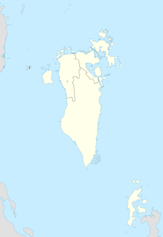
Deutsch: Positionskarte von Bahrain
English: Location map of Bahrain
|
||||||||||||
| Tarih | |||||||||||||
| Menba |
Own work using: |
||||||||||||
| Yaratıcı | NordNordWest and OpenStreetMap contributors | ||||||||||||
| SVG genesis | This map was created with Adobe Illustrator.
|
||||||||||||

Litsenziyalama
This file is licensed under the Creative Commons Attribution-Share Alike 2.0 Generic license.
- Azatsıñız:
- paylaşuv – qopyaluv, dağıtuv ve iletüv
- remiks etüv – uyğunlaştıruv
- Bu şartlar astında:
- attribution – You must give appropriate credit, provide a link to the license, and indicate if changes were made. You may do so in any reasonable manner, but not in any way that suggests the licensor endorses you or your use.
- aynı şekilde paylaşuv – If you remix, transform, or build upon the material, you must distribute your contributions under the same or compatible license as the original.
Faylnıñ keçmişi
Faylnıñ kerekli anki alını körmek içün tarihqa/saatqa basıñız.
| Tarih ve saat | Kiçik resim | En × boy | Qullanıcı | İzaat | |
|---|---|---|---|---|---|
| şimdiki | 23:08, 2015 s. fevralniñ 20 | | 1.246 × 1.808 (326 KB) | NordNordWest | upd |
| 14:37, 2014 s. noyabrniñ 13 |  | 1.246 × 1.607 (134 KB) | NordNordWest | == {{int:filedesc}} == {{Information |Description= {{de|1=Positionskarte von Bahrain}} {{en|1=Location map of Bahrain}} {{Location map series N |stretching= |top=26.6 |bottom=16.5 |left=51.8 |right=60.1 }} |Source={{Own using}} * [http:www.openstreetma... |
Fayl qullanıluvı
Bu saife qullana bu fayldı:
Umumiy fayl qullanıluvı
Bu vikilerde bu fayldı qullana:
- an.wikipedia.org qullanım
- ar.wikipedia.org qullanım
- كأس الخليج العربي 1
- جدة (جزيرة)
- جزيرة النبيه صالح
- بلاد القديم
- قالب:خريطة مواقع البحرين
- الدوري البحريني الممتاز 2010–11
- جزيرة أم النعسان
- الدوري البحريني الممتاز 2009–10
- الدوري البحريني الممتاز 2011–12
- الدوري البحريني الممتاز 2012–13
- الدوري البحريني الممتاز 2013–14
- جزيرة البحرين
- جزيرة أم الصبان
- جسر الملك حمد
- الدوري البحريني الممتاز 2015–16
- الدوري البحريني الممتاز 2016–17
- تفجير قرية الدراز 2017
- جزيرة الدار
- الدوري البحريني الممتاز 2021-22
- الدوري البحريني الممتاز 2020-21
- الدوري البحريني الممتاز 2022-23
- الدوري البحريني الممتاز 2023-24
- ast.wikipedia.org qullanım
- azb.wikipedia.org qullanım
- az.wikipedia.org qullanım
View more global usage of this file.