
Fayl:Wandkarte von Süd-West-Deutschland.jpg

Size of this preview: 800 × 594 pixels. Başqa çözüm: 320 × 238 pixels | 640 × 475 pixels | 1.024 × 760 pixels | 1.280 × 950 pixels | 2.560 × 1.900 pixels | 9.379 × 6.962 pixels.
Kerçek fayl (9.379 × 6.962 piksel, fayl büyükligi: 99,79 MB, MIME çeşiti: image/jpeg)
| Warning | The original file is very high-resolution. It might not load properly or could cause your browser to freeze when opened at full size. |
|---|
| Tasvir |
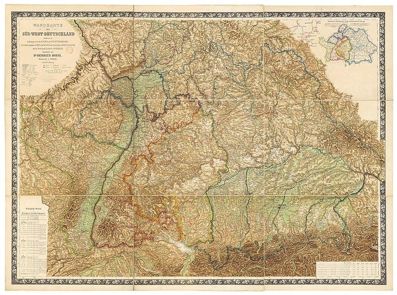
Deutsch: Wandkarte von Süd-West-Deutschland umfassend die Königreiche Bayern und Württemberg, die Grossherzogthümer Baden und Hessen, das Fürstenthum Hohenzollern und das Reichsland Elsass-Lothringen / bearbeitet von Dr. Heinrich Moehl.
English: Wall map of Southwestern Germany, which includes the Kingdom of Bavaria, Kingdom of Württemberg, the Grand Duchies of Baden and Hessen, the Principality of Hohenzollern, and the Imperial territory of Alsace-Lorraine, 1875. Edited by Dr Heinrich Moehl. |
||||
| Tarih | |||||
| Menba | Wandkarte von Süd-West-Deutschland umfassend die Königreiche Bayern und Wörttembergidie Grossherzogthümer Baden und Hessen, das Fürstenthum Hohenzollern und das Reichsland Elsass-Lothringen / bearbeitet von Dr Heinrich Moehl | ||||
| Yaratıcı | Moehl, Heinrich (18..-19..?). Auteur du texte ; Verlag von J.J. Tascher (Kaiserslautern) | ||||
| İzin (Faylnı yañıdan qullanuv) |
|
|
This image was selected as picture of the day on Wikimedia Commons for 25 August 2012. It was captioned as follows: English: Wall map of Southwestern Germany, which includes the Kingdom of Bavaria, Württemberg Principalities of Baden and Hessen, the Principality of Hohenzollern, and the Imperial territory of Alsace-Lorraine, 1875. Restored by Dr Heinrich Moehl. Other languages:
Deutsch: Wandkarte von Süd-West-Deutschland umfassend die Königreiche Bayern und Württemberg, die Grossherzogthümer Baden und Hessen, das Fürstenthum Hohenzollern und das Reichsland Elsass-Lothringen / bearbeitet von Dr. Heinrich Moehl English: Wall map of Southwestern Germany, which includes the Kingdom of Bavaria, Württemberg Principalities of Baden and Hessen, the Principality of Hohenzollern, and the Imperial territory of Alsace-Lorraine, 1875. Restored by Dr Heinrich Moehl. Italiano: Mappa della Germania sud-occidentale con il Regno di Baviera, il Granducato di Baden, l'Hohenzollern-Hechingen e l'Alsazia-Lorena, a cura del dr. Dr Heinrich Moeh, 1875 Magyar: Délnyugat-Németország egy 1875-ös fali térképen Nederlands: Wandkaart van het zuidwesten van Duitsland met inbegrip van de koninkrijk van Beieren, Groothertogdom Baden, Groothertogdom Hessen, vorstendom Hohenzollern en het Reichsland Elzas-Lotharingen, onder de redactie van Heinrich Moehl. Русский: Настенная карта юго-западной Германии, 1875 中文: 德国西南部1875年地图,包括巴伐利亚、巴登、黑森和阿尔萨斯-洛林。 |
Faylnıñ keçmişi
Faylnıñ kerekli anki alını körmek içün tarihqa/saatqa basıñız.
| Tarih ve saat | Kiçik resim | En × boy | Qullanıcı | İzaat | |
|---|---|---|---|---|---|
| şimdiki | 18:40, 2012 s. iyülniñ 14 | | 9.379 × 6.962 (99,79 MB) | ComputerHotline | {{Information |Description={{LargeImage}}{{de|Wandkarte von Süd-West-Deutschland umfassend die Königreiche Bayern und Wörttembergidie Grossherzogthümer Baden und Hessen, das Fürstenthum Hohenzollern und das Reichsland Elsass-Lothringen / bearbeite... |
Fayl qullanıluvı
Bu saife qullana bu fayldı:
Umumiy fayl qullanıluvı
Bu vikilerde bu fayldı qullana:
- be-tarask.wikipedia.org qullanım
- bn.wikipedia.org qullanım
- cv.wikipedia.org qullanım
- fr.wikipedia.org qullanım
- hu.wikipedia.org qullanım
- ka.wikipedia.org qullanım
- kk.wikipedia.org qullanım
- ko.wikipedia.org qullanım
- krc.wikipedia.org qullanım
- lbe.wikipedia.org qullanım
- os.wikipedia.org qullanım
- pt.wikipedia.org qullanım
- ru.wikipedia.org qullanım
- ru.wikinews.org qullanım
- sah.wikipedia.org qullanım
- uk.wikipedia.org qullanım
- xal.wikipedia.org qullanım
- zh.wikipedia.org qullanım