
Fayl:Outline Map of Altai Krai.svg

Size of this PNG preview of this SVG file: 512 × 382 pixels. Başqa çözüm: 320 × 239 pixels | 640 × 478 pixels | 1.024 × 764 pixels | 1.280 × 955 pixels | 2.560 × 1.910 pixels.
Kerçek fayl (SVG faylı, nominal 512 × 382 piksel, fayl büyükligi: 295 KB)
Faylğa ait qısqa tarif
| Tasvir |
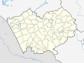
Русский: Позиционная карта Алтайского края
|top    = 55
|bottom = 50
|left   = 77
|right  = 88
English: Positional map of the Altai Territory
The projection is equiangular. The standard parallel is 52°30'N. Template parameters (edge coordinates): |
| Tarih | |
| Menba |
|
| Yaratıcı | Виктор В |
| Other versions |
[] |
| SVG genesis |


Litsenziyalama
This file is licensed under the Creative Commons Attribution-Share Alike 2.0 Generic license.
- Azatsıñız:
- paylaşuv – qopyaluv, dağıtuv ve iletüv
- remiks etüv – uyğunlaştıruv
- Bu şartlar astında:
- attribution – You must give appropriate credit, provide a link to the license, and indicate if changes were made. You may do so in any reasonable manner, but not in any way that suggests the licensor endorses you or your use.
- aynı şekilde paylaşuv – If you remix, transform, or build upon the material, you must distribute your contributions under the same or compatible license as the original.
Faylnıñ keçmişi
Faylnıñ kerekli anki alını körmek içün tarihqa/saatqa basıñız.
| Tarih ve saat | Kiçik resim | En × boy | Qullanıcı | İzaat | |
|---|---|---|---|---|---|
| şimdiki | 22:51, 2016 s. avgustnıñ 28 | | 512 × 382 (295 KB) | Gajmar | Slavgorod, Kamen-na-Obi |
| 16:08, 2010 s. sentâbrniñ 26 |  | 512 × 382 (294 KB) | Виктор В | == {{int:filedesc}} == {{Information |Description={{ru|1=Позиционная карта Алтайского края *Проекция — равноугольная. *Стандартная параллель — 52°30'с.ш. *Параметры ш� |
Fayl qullanıluvı
Bar yoq 100 saife bu fayldı qullana. Mına cedvel köstere qaysı birinci saifeler sadece bu fayldı qullana. Episinide köstergeni tapıla.
- Aleksandrovskiy (Altay ülkesi)
- Aleysk
- Aleyskiy
- Altayskoye (Altayskoye rayonı)
- Amurskiy (Altay ülkesi)
- Aya (köy)
- Barnaul
- Basargino (Altay ülkesi)
- Bayevo (Altay ülkesi)
- Behtemir-Anikino
- Beloye (Altayskoye rayonı)
- Berözovaya Gorka
- Berözovskiy (Aleysk rayonı)
- Bezgolosovo
- Bolşaya Kırkıla (qasaba)
- Bolşepanüşevo
- Bolşeugrenövo
- Boriha (Altay ülkesi)
- Borovoy (Altay ülkesi)
- Borovskoye (Altay ülkesi)
- Bulatovo (Altay ülkesi)
- Buluhta (qasaba)
- Danilovka (Altayskoye rayonı)
- Drujba (Aleysk rayonı)
- Dubrovskiy (Altay ülkesi)
- Jeleznodorojnaya Kazarma 347 km
- Jeleznodorojnaya Kazarma 363 km
- Kabakovo (Altay ülkesi)
- Kapustinka (Altay ülkesi)
- Katun (Altay ülkesi)
- Kazanka (Altay ülkesi)
- Kaşino (Altay ülkesi)
- Kirovskoye (Altay ülkesi)
- Klüçi (Biysk rayonı)
- Komar (Altay ülkesi)
- Kondratyevskiy
- Krasnodubrovskiy (Aleysk rayonı)
- Krasnıy Yar (Aleysk rayonı)
- Kuyagan (köy)
- Kuyaça (köy)
- Lesnoye (Biysk rayonı)
- Makaryevka (Aitayskoye rayonı)
- Malahovo (Aleysk rayonı)
- Malinovka (Aleysk rayonı)
- Malougrenövo
- Maloyeniseyskoye
- Maltseva Kurya
- Mamontovskiy
- Mohovskoye
- Nijnekamenka (Altay üllesi)
- Nijnekayança
- Nijnepayva
- Nijneçumanka
- Nikolskoye (Altayskoye rayonı)
- Novokolpakovo
- Novonikolskiy (Altay ülkesi)
- Oktâbrskiy (Aleysk rayonı)
- Oskolkovo (Altay ülkesi)
- Paklino (Altay ülkesi)
- Pavlovka (Bayevo rayonı)
- Pervomayskiy (Aleysk rayonı)
- Plotava (Aleysk rayonı)
- Plotava (Bayevo rayonı)
- Pokrovka (Bayevo rayonı)
- Priyatelskiy
- Proletarka (Altay ülkesi)
- Proslauha
- Rossoşi (Altay ülkesi)
- Rudnik (Altay ülkesi)
- Rıbnıye Borki
- Safronovo (Altay ülkesi)
- Sarasa (köy)
- Savinka (Altay ülkesi)
- Serebrennikovo (Altay ülkesi)
- Sitnikovo (Altay ülkesi)
- Solneçnıy (Altay ülkesi)
- Sovhoznıy (Altay ülkesi)
- Starobelokuriha (köy)
- Tolstaya Dubrova
- Tourak
- Troitskiy (Altay ülkesi)
- Urjum (Altay ülkesi)
- Urüpino (Altay ülkesi)
- Uspenovka (Altay ülkesi)
- Vavilon (Altay ülkesi)
- Verh-Aya
- Verh-Behtemir
- Verh-Katunskoye
- Verh-Payva
- Verh-Çumanka
- Vetölki (Altay ülkesi)
- Vostoçnıy (Biysk rayonı)
- Yazevka-Sibirskaya
- Yeniseyskoye
- Zaozörnıy (Altay ülkesi)
- Zarâ (Biysk rayonı)
- Zavetı İliça (Altay ülkesi)
- Zelönaya Polâna (Aleysk rayonı)
- Çeremşanka (Altayskoye rayonı)
- Çernışevskiy (Altay ülkesi)
View more links to this file.
Umumiy fayl qullanıluvı
Bu vikilerde bu fayldı qullana:
- af.wikipedia.org qullanım
- alt.wikipedia.org qullanım
- ar.wikipedia.org qullanım
- azb.wikipedia.org qullanım
- ارموشیخا
- اوبرازتسووکا
- اوبسکوی، روسیه
- اوترادا، آلتای دیاری
- اوترادنوی، آلتای دیاری
- زاکلادنوی
- زاکووریاشینو
- اوتیانکا
- زاوتی ایلییچا، آلتای دیاری
- بلوقلازووو
- اودالنوی
- بلووو، آلتای دیاری
- اودینتسووکا
- بلوی، آلتای دیاری
- زتلان، روسیه
- زرکالی، روسیه
- زرنو، روسیه
- زلاتوپول، آلتای دیاری
- کیسلوخا، روسیه
- زلیونایا پولیانا، آلتای دیاری
- زلیونایا دوبراوا
- زلیونایا دوبراوا، آلتای دیاری
- زلیونایا روشچا، آلتای دیاری
- اورخووو، آلتای دیاری
- زلیونی لوق
- بوبرووکا
- بوبرووکا، آلتای دیاری
- کیلتی، آلتای دیاری
- اورژوم، آلتای دیاری
- زملیانوخا
- بوبکووو، روسیه
- زنئیمنکا، آلتای دیاری
- اورلاپووو
- کینرال، روسیه
- اورلووکا، آلتای دیاری
- اورلووو، روسیه
- اورلین، آلتای دیاری
- زوزرنی، آلتای دیاری
- بور-فورپوزت
- بور-کوزوبولات
- زولوتوخا، آلتای دیاری
- کئیمنکا، آلتای دیاری
- بورانووکا
View more global usage of this file.